Northwestern University required the completion of a campus site survey that would advance the geospatial data activities already underway by its Facilities Department and campus staff. Having completed similar asset management projects for the University of Iowa and South Dakota State University, HR Green was awarded the project.
HR Green set up a Geographic Information Systems (GIS) deliverable for the university using an enterprise GIS database. HR Green developed this GIS deliverable using strictly non-proprietary software available “off-the-shelf” from ESRI, the world’s leading GIS software provider. The use of this GIS format would allow the campus to ultimately access its GIS data inside ArcGIS and take full advantage of ESRI software functionality.
HR Green GIS specialists reviewed the University’s existing spatial data. Given the incomplete state of this data, it was decided that a complete asset inventory of the campus was required rather than attempting to fill gaps within the existing datasets. Before embarking on a full campus inventory, a pilot asset inventory was undertaken to verify the completeness of database design and establish best practices for field collection. After the pilot was completed, a meeting was held between Northwestern University and HR Green GIS staff to identify any changes to the database that might be needed prior to the full campus inventory. This asset inventory focused primarily on the locating of assets and the identification of the asset type and the system (e.g., electric, natural gas, water, etc.) to which it belonged. Photos of the assets were also taken and attached to the asset’s point feature in the GIS database.
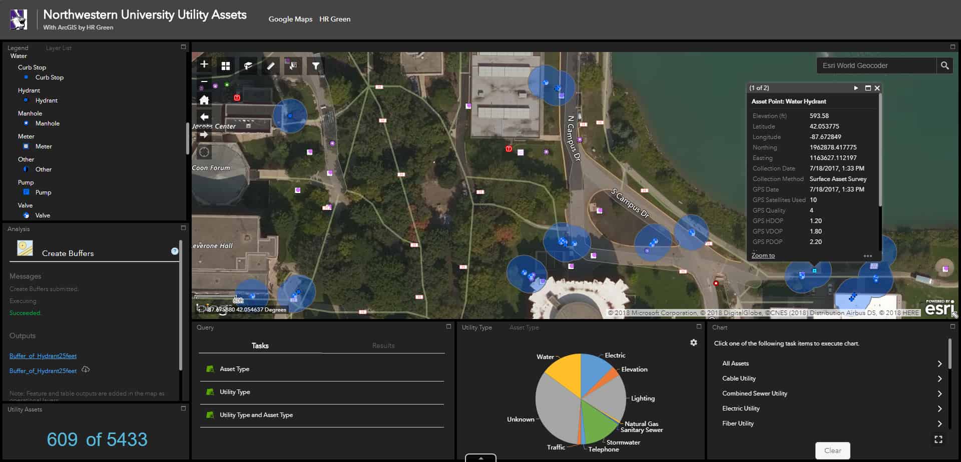
For quality assurance purposes, HR Green designed each asset class in the campus GIS database to include important progress and status fields that allow campus staff to keep track of the completeness and quality of campus GIS data. These fields include Collection Method, GPS Service Used, and GPS Collection Quality. When collecting GPS locations using HR Green-designed ArcPad deployments, the following data quality and date/time fields were scripted to auto-populate in real-time: GPS Date, GPS Time, Number of GPS Satellites Used, GPS Quality Score, GPS Horizontal Dilution of Precision (HDOP), GPS Vertical Dilution of Precision (VDOP), and GPS Positional Dilution of Precisions (PDOP).
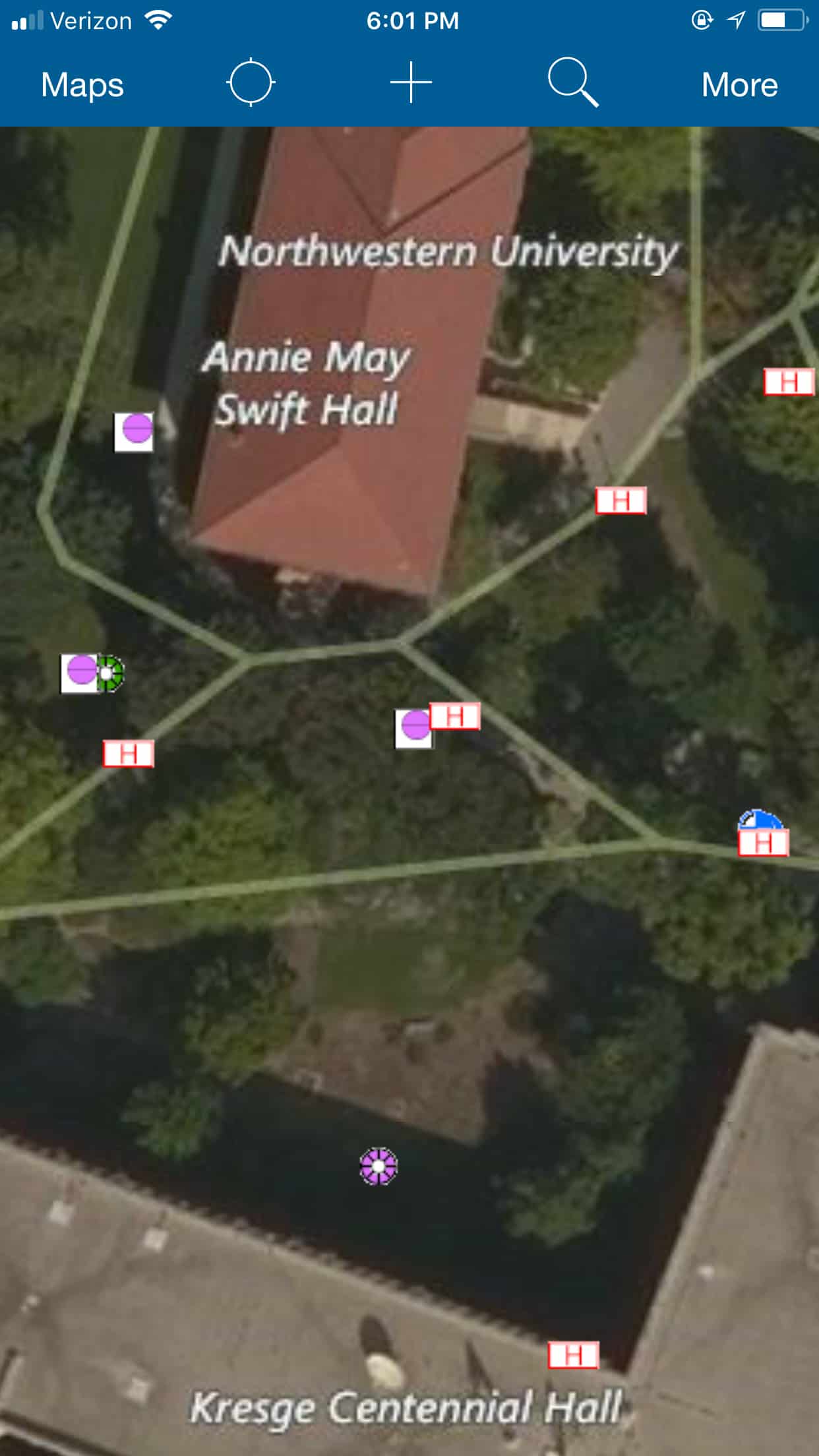
HR Green also developed an ArcGIS Online (AGOL) project portal for Northwestern University officials to use during the inventory. University staff had access to a secure, multi-user repository of ArcGIS Online (AGOL) maps and applications (e.g. Collector for ArcGIS, Operations Dashboard) useful for tracking progress and noting the location of assets requiring maintenance or additional investigation. HR Green provided University staff with access to a collection of web maps organized by system type in addition to a comprehensive map including all campus systems combined. These applications provided valuable GIS functionality to the campus while remaining user-friendly to staff without a GIS background.