3D Design Tools Save Time, Money and Aid in Collaboration
The use of 3D Design tools aids engineers in evaluating designs and the conditions present that can create construction delays, cause expensive changes to the design, or could affect long-term maintenance costs if not adequately analyzed at key steps in the design process. Advances in 3D modeling software also allow evaluations of critical project risk factors earlier in the infrastructure planning and design process including the ability to:
- Visualize underground features and their relation to the 3D space
- Realistically model subsurface features of underground utility networks and structural elements to identify and resolve conflicts
- Optimize facility placement or resource location
- Approximate a more accurate project footprint earlier in the design process
- Identify processes and spatial patterns when looking for problem solutions
- Examine future maintenance activity work zones to optimize facility placement
- Examine and calculate volumes of subsurface structures and networks
3D Design Project Experience
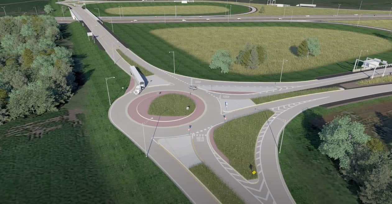
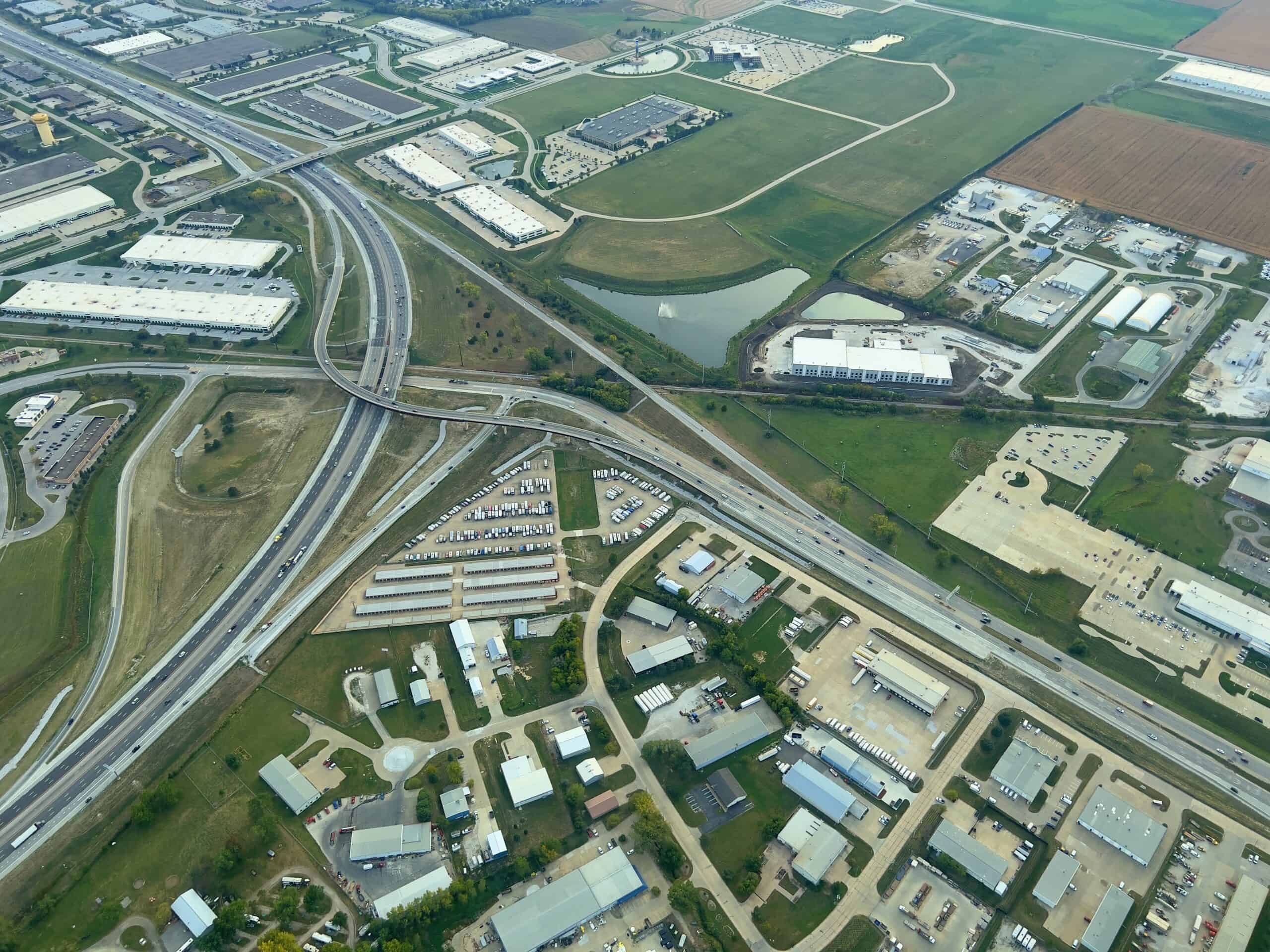
HR Green has used 3D modeling in several recent projects with excellent results. In Illinois when tasked to evaluate and design a seven-mile segment of Freeway/Tollway, including a new systems interchange with a closely spaced existing service interchange, Corridor Modeler was utilized in the schematic/preliminary design phase to evaluate project footprints and analyze environmental impacts in addition to visualizing sightlines, traffic weaving conditions and refinement of geometric alignments. When supplemented with traffic operations analysis, the 3D visualization led to developing a preferred systems interchange concept featuring two loop ramps and two fly-over structures that balanced cost, operations, safety and minimized environmental impacts.
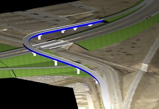
Corridor Modeler was also used during an Iowa project to widen six miles of two-lane rural highway to a four-lane divided, accessed controlled facility with two diamond interchanges and relocation of side-roads. A 3D model was developed with sufficient design detail for use by automated machine control technologies for construction. This work included detailing, in 3D, bridge foundations and the associated spill slope grading, surface drainage grading, ramp merge/diverge grading, and other grading features.
Finally, as the lead consultant on an extensive study and design project for 10 miles of rural and urban interstate, including six service interchanges, a system interchange, and a labyrinth of subsurface utilities; 3D Design was critical in evaluating construction phasing, ROW impacts, and long-term maintenance impacts of the proposed design.
The use of 3D Design techniques improves quality, reduces risk, improves collaboration with project stakeholders, and allows an early focus on the technical review.
The project parallels the Missouri River, a railroad line, and access to an urban center. The design needed to consider the relocation of both public and private utilities, accommodation for trunk storm sewer outfalls that cut across the corridor, maintenance of critical ITS and communication infrastructure, soil remediation for soft and compressible soils along with staging to replace existing and proposed bridges/walls while maintaining traffic. GEOPAK Corridor Modeler, GEOPAK Drainage, and GEOPAK Water/Sewer applications were utilized to analyze both existing and proposed improvements in 3D for:
- Conflict detection for subsurface features among structures, private utilities, and public utilities.
- Evaluate trench limits for proposed utility and structure excavations to determine viable corridors for private utility relocations such that they only need to relocate once.
- Evaluate potential excavation limits for future water main maintenance to minimize complications and the cost of future maintenance.
- Identify areas of soil remediation that needed to be advanced in the construction schedule to accommodate utility relocations and other sequential critical work.
- Visualize special underground structure details in relation to utility excavations to minimize the need for shoring.
- Facilitate on-the-fly re-engineering of grading details in critic
These examples show the diverse benefits of 3D modeling in real-world situations. The use of 3D Design techniques improves quality, reduces risk, improves collaboration with project stakeholders, and allows an early focus on the technical review.
For projects in constrained urban environments, complex topographic situations, areas with sensitive environmental resources, or even rural expressways, the small percentage up-front investment in 3D design, construction staging analysis, and sub-surface utility investigation will reduce the risk for scope creep, reduce rework to NEPA products, lower risk to schedule delays due to ROW acquisition or utility relocation and will also help keep projects on budget.

Subscribe to HR Green Insights
We're dedicated to providing up-to-date knowledge and insights about the topics that matter most to you. We know how busy you are, so we will keep this simple, covering just one topic per email. Once you've subscribed, you can easily customize your preferences to receive only the updates relevant to you.