The challenges to transportation project designers are more difficult today than ever. Right-of-way (ROW), easements, utility adjustments, and the ability to efficiently stage construction while safely maintaining traffic are critical factors to keep projects on track, especially in constrained urban settings. Add to the mix are a broad range of regulatory clearances that must be obtained in a sequential manner during the National Environmental Policy Act (NEPA) process to keep the project on schedule. These clearances are often based on conceptual and preliminary design that if not thoroughly developed during the location and route studies phase can lead to rework and schedule delays later in the project life cycle.
To add to the mix of complex transportation projects is a broad range of regulatory clearances that must be obtained in a sequential manner during the National Environmental Policy Act (NEPA) process to keep the project on schedule. These clearances are often based on conceptual and preliminary design that if not thoroughly developed during the location and route studies phase can lead to rework and schedule delays later in the project life cycle.
Partnering with a firm that has the ability to navigate the entire project development process by guiding a complex transportation project from initial planning, through final design, and ultimately completed construction has many advantages. The advantages become especially clear if this firm has a variety of experience ranging from scenic rural highways to congested urban freeways. The experience gained from a diverse collection of projects allows for the anticipation of challenges early in the design process that has the potential to disrupt and delay the completion of a project.
The strategy to confront these design challenges is relatively simple: implement tactics and technologies early in project development that results in a preferred alternative that is funded, maintains a firm ROW footprint, sorts out utility adjustments, and can be constructed with minimal impact to the mobility and safety of the traveling public. The results of the location and route studies phase are really no different now than it was decades ago, but the manner and confidence in which the results are achieved is much different.
Location and route studies involve a variety of data collections, analyses, and designs for multiple alignment alternatives so that project leadership and stakeholders can determine a preferred alternative. The more comprehensive the studies the more definitive are the results.
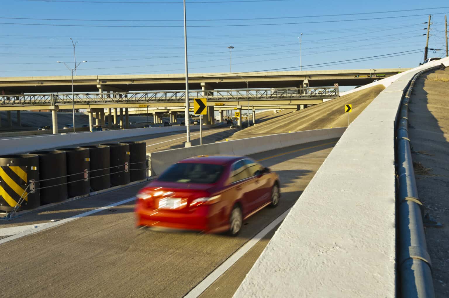
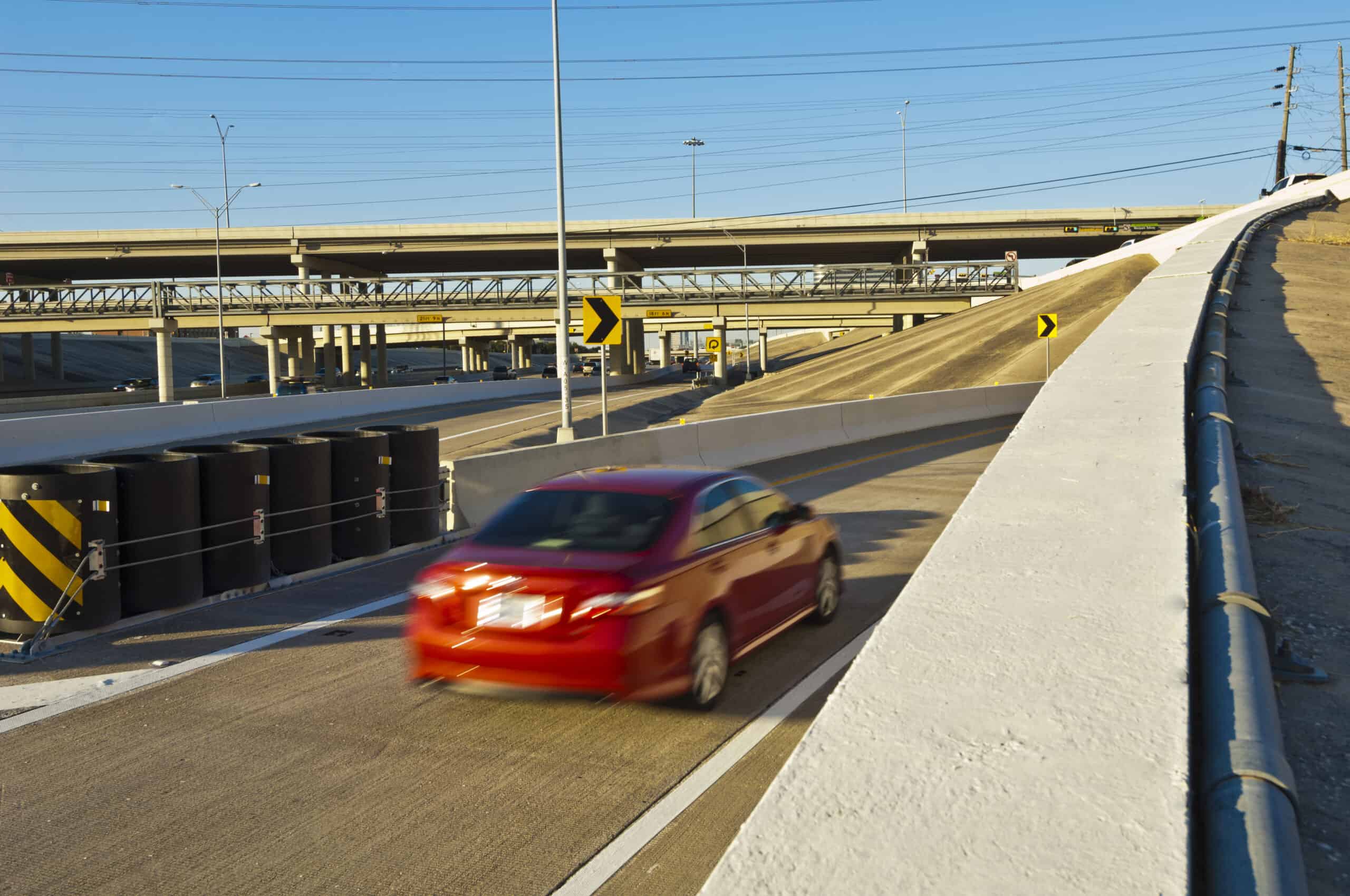
Horizontal and vertical alignments establish the basic geometric elements of low-volume rural highways, congested urban freeways, and everything in between. Those two dimensions have long been the backbone in the design of roadway facilities and integrated with the third dimension, a typical section or cross-section, the facility takes shape. Highly skilled transportation designers have always had the ability to visualize and integrate all three dimensions with the tools and technology available to them. As technology evolves the agencies and firms that embrace that evolution are implementing it early in the location and route studies phase when the most critical design factors are considered.
Complex Transportation Technology
One approach that is increasingly being deployed is the development of 3-D design models during preliminary design and alternative analysis. Early development of 3-D models using tools available in software such as Bentley’s GEOPAK allows for informed decisions on design alternatives with respect to ROW and ultimately the project footprint. Models created by designers can provide an interactive and visual depiction of alternatives to allow stakeholders to make better-informed decisions.
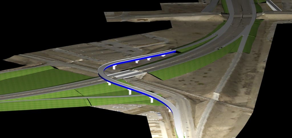
Comprehensive 3-D models also prove to be a valuable asset in public involvement. By integrating the models with traffic microsimulation using software such as VISSIM, the proposed project takes on a life that affected landowners and the general public can relate to and better understand. The deeper the understanding of a complex transportation project, the more connected the public is to the process and the more positive the perception of the process. This leads to more effective coordination with landowners and establishes a good starting point for communicating potential ROW acquisitions while at the same time respecting the NEPA decision-making process.
Preferred Alternatives
Successfully determining a preferred alternative during the location and route studies phase involves more than just utilizing the latest technology, it also involves engaging in tasks that may have typically been performed during a later phase of project development such as sub-surface utility investigations or construction phasing analysis, development of temporary traffic control concepts, and constructability reviews.
Urban corridors are often littered with utilities that present design and schedule challenges. Collecting detailed survey and existing sub-surface utility data early in project development is extremely valuable in preliminary design. Integrating the sub-surface utility data with 3-D models allows horizontal and vertical utility conflicts to be quickly identified and designers can develop cost-effective solutions to limit impacts to utilities. For example, a major electric transmission line and high-pressure gas line may pass through a project area. A 3-D model can evaluate how best to position critical infrastructure to avoid a costly gas main relocation and provide more options for high power lines.
Optimizing the roadway design elements is only one advantage of early utility investigations. Designers can also allocate the appropriate border widths for utility accommodations. Utility accommodations can play a major role in determining the proposed ROW or potential easements adjacent to the project ROW that set the project footprint utilized in NEPA documentation. With this level of design project managers can also engage in utility adjustment coordination early in project development, potentially saving time and costs for the overall project.
A preferred alternative is the goal of location and route studies, but a preferred alternative is no alternative at all if consideration has not been given to constructability or managing traffic during construction. Urban corridors often present the most significant challenge in evaluating the constructability of various alternatives. Traffic volumes are high and capacity, mobility, and access are major factors just as safety is with any temporary traffic control plan.
Team Experience
A project team that has design professionals experienced in developing construction sequencing concepts and detailed maintenance of traffic or traffic control plans elevates the team’s ability to produce a viable alternative in the location and route studies phase. Collaborating with internal construction professionals that have observed and managed construction of complex transportation projects further solidifies the team’s credibility.
Collaborating with internal construction professionals that have observed and managed construction of major transportation projects further solidifies the team’s credibility.
As transportation projects grow more complicated having one, experienced client-focused engineering firm with a diverse membership of professionals is essential. Collaborating early in project development during location and route studies when the most critical designs, analysis, and decisions occur sets the stage for efficient NEPA documentation and final design, and ultimately a successful construction project. Implementing the latest technology available, developing cost-effective solutions to anticipated challenges, and then shepherding the project to completion is a skill developed over years of working on complex projects big and small.
HR Green has more than 100 years of engineering experience and employs staff that has worked on complex urban reconstruction projects in some of the nation’s largest metropolitan areas including Chicago, Houston, and Dallas-Fort Worth as well as thriving urban centers in America’s Heartland such as St. Louis, Cedar Rapids, Des Moines, Sioux City, and Omaha-Council Bluffs. By combining planning, design, and construction a seamless experience is created for clients.