
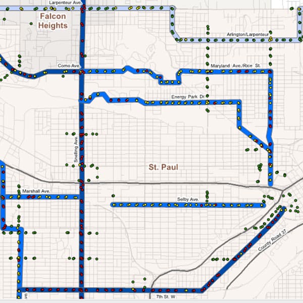
As part of a transit study, bus stops in Metropolitan Council communities were evaluated using Geographic Information Systems (GIS). GIS modeling played a critical role in systematically and defensibly ranking bus stops based on deficiencies and improvement potential as it related to accommodating the needs of pedestrians and cyclists.
GIS data was collected from a variety of sources for use in this analysis. This data gathering included data from partnering communities, public sources, and field data collected by HR Green staff. Mobile GIS custom forms were developed for HR Green data collection efforts, and collected field data was then integrated into the project GIS database. Mobile GIS was used by HR Green to gather site-specific access and amenity data for selected routes where minimal existing data was present.
HR Green planners and GIS specialists devised a method to rank bus stops based on improvement needs. A GIS model was developed to score how well bus stops met a variety of criteria, resulting in a final overall score.
Large poster maps were created to display the results of the transit study for a variety of different criteria. Multiple database reports were created to illustrate priority levels for improvements based on the criteria selected. Reports were generated for the entire study area, individual municipalities, and specific improvement projects.