Many communities across the country are starting to research sUAS (drone) uses and invest in sUAS technology and applications. They can have many uses within the public sector besides the obvious for high-resolution aerial photography. The following are some unique applications that can benefit your public agency.
Posted with permission from Illinois City/County Management Association, May 2017. Read the original article here.
Environmental
sUAS can be used for environmental monitoring for things such as wetland studies using infrared (IR) imagery to help index vegetation for native wetland species. The imagery could also be used to monitor erosion, deforestation, and areas after natural disasters. Looking to clean up blighted properties in your community? sUASs can now be used to supplement environmental Phase I Environmental Site Assessment (ESA) surveys in areas where access is difficult due to vegetation or terrain.
Asset Management and Inspections
There are also many uses for asset management for your community when the asset’s precise location is unknown. Using sUAS technology can help a community determine the exact location and the condition of these assets and can then incorporate them into the community’s Geographic Information System (GIS) database. For example, the use of a thermal sensor during cooler times of the year may be useful in locating sanitary sewer manholes in difficult terrain.
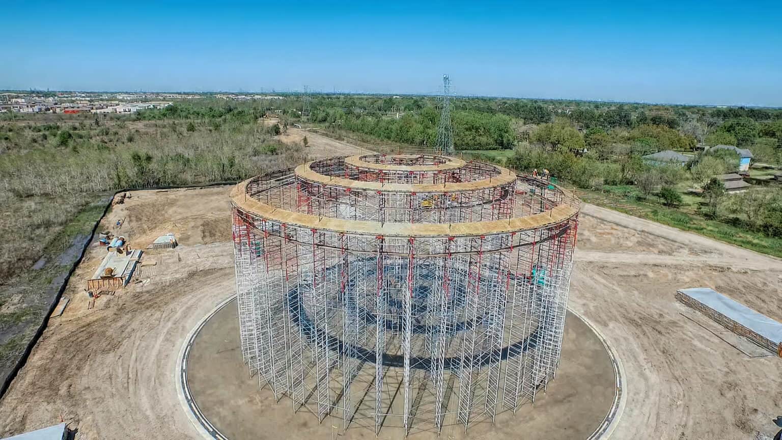
Some inspections made by municipalities can be somewhat dangerous (i.e., roofs, bridges, water towers, dams, etc.). sUAS data for inspections can help minimize liability and can help prevent accidental damage to property and improve Inspector safety. The imagery from most sUASs is extremely impressive. This high-quality imagery can assist with things such as corridor design and construction, pavements evaluations, and detailed before-and-after site photos.
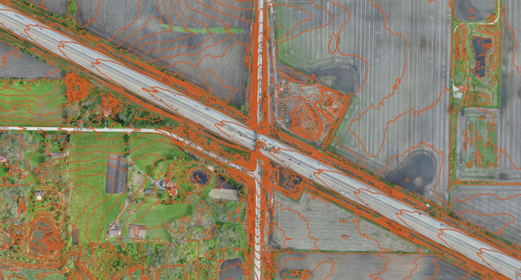
Surveying and Terrain Mapping
If your community has areas with difficult terrain that need surveying, the use of specialized equipment can be utilized by sUASs to complete accurate terrain maps down to 1” in relative accuracy. This can lead to efficiency improvements over traditional survey methods in certain cases. However, this method of topographic mapping is limited by vegetation, such as typical mowed grass, gravel, shrubs/ bushes, and tree canopies. In addition to terrain mapping, this same technology can be used to provide estimated volumes for things such as soil piles and excavations for design applications and contractor payment evaluations.
Although the use of sUAS technology is expanding rapidly, there are some implications that your public agency needs to consider. Whether you decide to purchase sUASs or hire an experienced company, the use of sUASs has presented some challenges that can affect your decision. Issues that need to be taken into consideration are safety, trespassing, and privacy issues when operators fly them too close to airports, buildings, schools, and groups of people. The FAA also plays a role in whom, how, and where these can be used, especially for commercial purposes. The sUAS operators need to be licensed through the FAA and may also need to get FAA and Air Traffic Control clearance to fly in certain areas, especially near airports. sUAS missions are tough to do over crowds of people and tend to not work well in high winds and precipitation. These are all some of the considerations needed when deciding how to go about utilizing sUAS for your communities.
Although there are some barriers to leveraging sUASs, the advantages to your municipality and constituents can easily outweigh the initial research and costs. The time and money saved, and the outcome of the advanced imagery available, still make sense to consider for the long run.