Challenge
The Kingwood area in Houston, Texas has experienced significant flooding, both from local stormwater and overflow from open channels like Taylor Gully. Residents and businesses were facing ongoing flood risks. The Harris County Flood Control District (HCFCD) and the Lake Houston Redevelopment Authority (TIRZ 10) needed a comprehensive analysis to identify the flooding source and implement a solution.
Solution
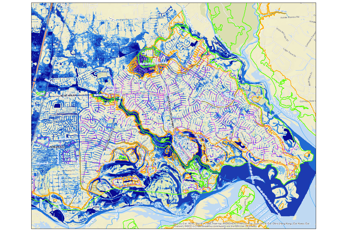
Our team played a critical role in the Kingwood Drainage Study by developing a detailed two-dimensional (2D) hydrologic model of the area. This effort included:
- Evaluated key drainage channels, including Taylor Gully, to understand water conveyance capacity.
- Created a full-area model that captured overland flow patterns, identifying areas at risk of flooding both inside and outside of channel floodplains.
- Utilized multiple data sources, including 2018 LiDAR surface data, the City of Houston’s storm sewer network (GIMS), and land use files to build an accurate flood model.
Benefit
The study provided a clearer understanding of both localized and channel-based flooding in Kingwood, enabling the identification of effective flood mitigation strategies. The 2D model proved instrumental in determining which areas required immediate intervention and which were most vulnerable to future events.


