GIS Brownfield Prioritization Model Makes Sense of Diverse Data
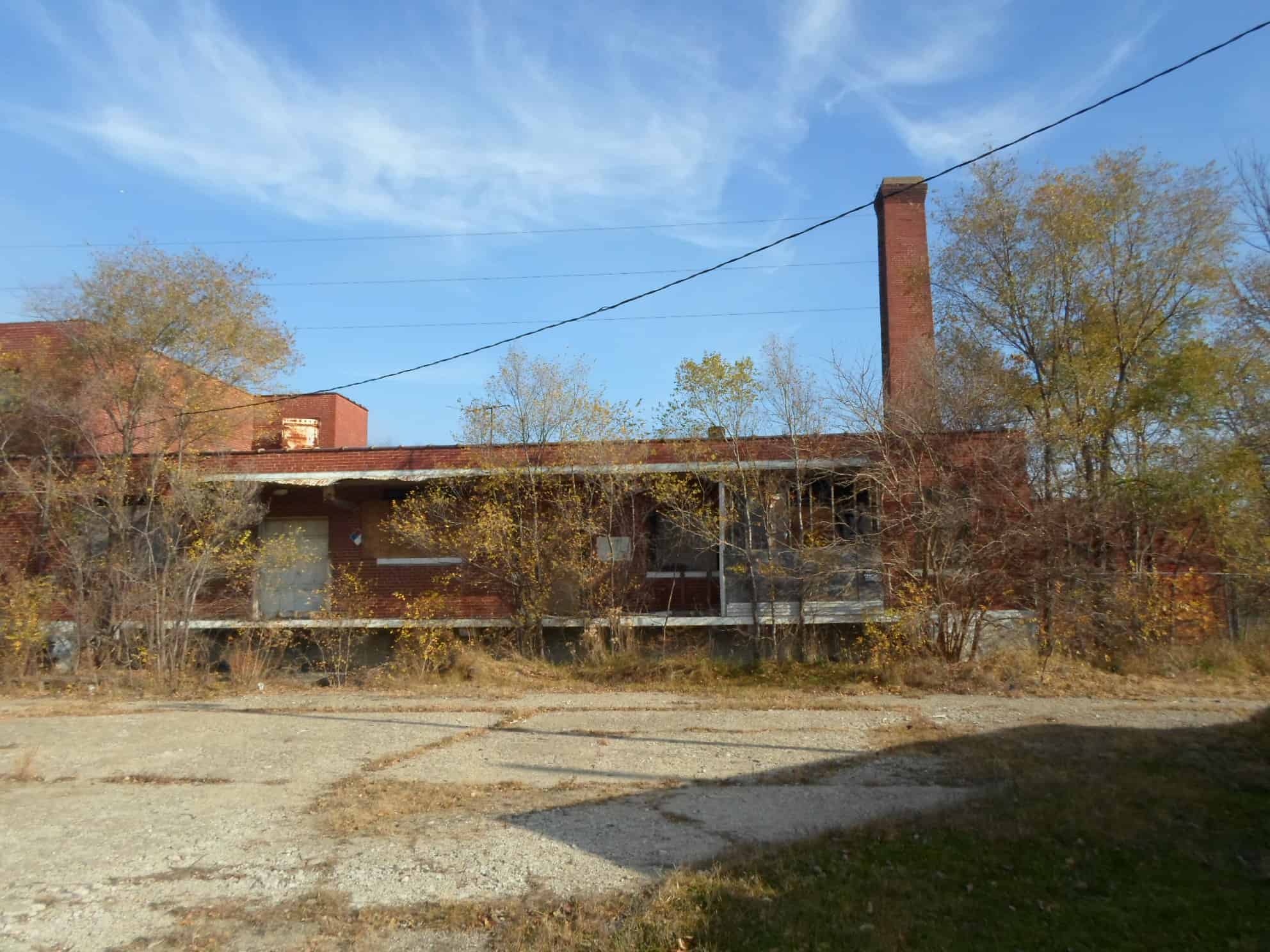
Brownfields are defined by the EPA as “real property, the expansion, redevelopment, or reuse of which may be complicated by the presence or potential presence of a hazardous substance, pollutant, or contaminant.” Cleaning up and reinvesting in these properties increases local tax bases, facilitates job growth, utilizes existing infrastructure, takes development pressures off of agricultural land and greenspaces, and improves human health.
Brownfield redevelopment is a multi-phased, multi-stakeholder undertaking that involves a property being assessed; its future land use considered by a wide array of interests (e.g. community members, local governments, private sector, environmental regulators); its future use possibilities weighed against other local land use efforts and zoning; and it then being remediated, redeveloped, and put back into productive use.
The EPA estimates that within the U.S., there are more than 450,000 brownfields. Yet, identifying, categorizing, and prioritizing which of these sites is worthy of federal and state funds can be a daunting task. Geographic Information Systems (GIS) can make this task easier, but simply creating a pretty map is not going to provide the depth of information needed to thoroughly examine an entire community.
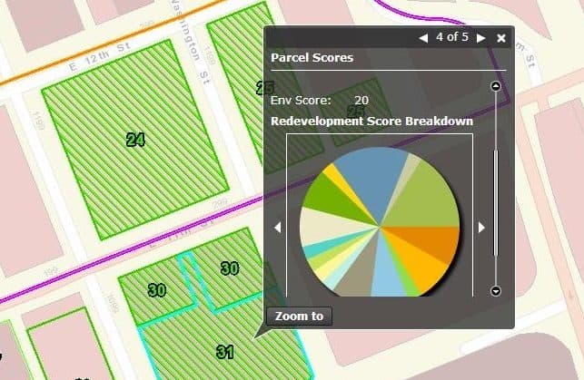
HR Green has moved beyond a ‘pretty map’ in developing a GIS Brownfield Prioritization Model that identifies potential brownfield properties and scores them based on environmental risk and redevelopment potential. This model seeks to assign higher redevelopment scores to properties most likely to be desirable to developers as ‘shovel-ready sites’ for reuse following cleanup.
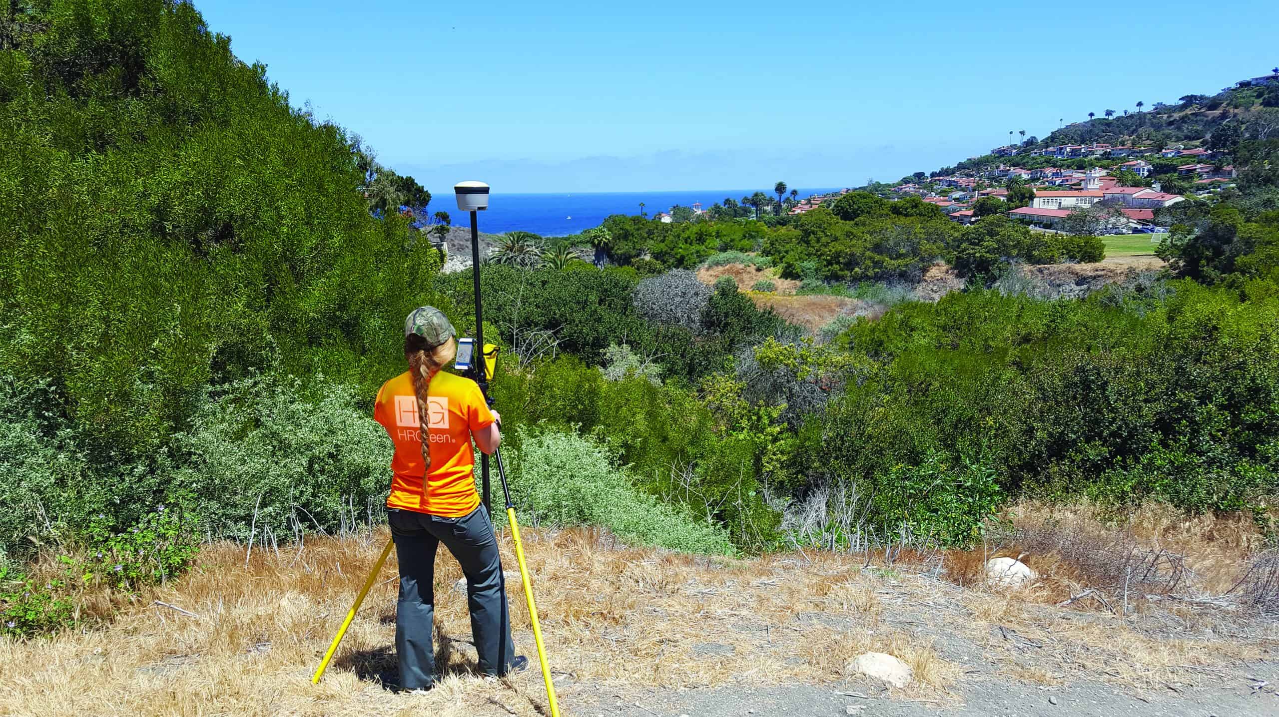
The HR Green GIS brownfield model is a critical component in HR Green’s comprehensive approach for identifying brownfield redevelopment opportunities. The GIS model is robust enough to give full and equal consideration to every parcel in a community. Thousands of city parcels are systematically evaluated against dozens of environmental and redevelopment GIS map layer criteria as a part of this automated model. The model performs a consistent, thorough analysis that could simply not be accomplished within project time and budget constraints via a manual process. It has two objectives.
The first modeling objective involves mining the environmental data to determine what community properties exhibit brownfield potential. Again, revisiting the EPA definition, HR Green is seeking to find those properties with “the presence or potential presence of a hazardous substance, pollutant, or contaminant.” Without meeting this basic definition, no EPA funds can be expended on a property.
That said, not all properties meeting this minimum definition show the same level of environmental risk. For example, one property may show a single potential source of contamination located just within the acceptable distance limit to the property. Another property may have a myriad of environmental concerns on-site ranging from illegal dump sites to leaking underground storage tanks to former mines.
The second modeling objective is to evaluate properties for their future development potential. Many considerations factor into redevelopment potential. Is a property located near required utilities (sewer, water, electric, fiber, etc.)? Does a property have an adequate area for the desired reuse? Does a property fall within a community district identified for urban renewal? HR Green’s GIS brownfield model examines these redevelopment criteria and many more in generating scores for every community property.
These results are then delivered to HR Green environmental scientists and, ultimately, to community stakeholders, at which time the highest-scoring properties are studied and scrutinized in detail to arrive at a list of properties for the community to pursue. This “ground truth” review depends on environmental professionals and community stakeholders using their expertise to go beyond the model results, often applying local knowledge in determining property suitability on a case-by-case basis.
In summary, the HR Green approach to identifying favorable brownfield redevelopment properties can be divided into three parts:
- Environmental Risk – Identifying a defensible potential for environmental risk is necessary for receiving any funds from the EPA to perform an environmental site assessment and move forward on clean-up. The HR Green GIS Brownfield Prioritization Model evaluates every parcel in a community for environmental risk, filtering out those showing no risk and scoring the rest based on the cumulative risk posed by a variety of different environmental criteria.
- Redevelopment Potential – The redevelopment potential of a site is also taken into consideration and scored by the HR Green GIS Brownfield Prioritization Model. Proximity to major transportation corridors, water service, and fiber optic networks are a few of the many redevelopment factors examined by the GIS model in generating each parcel’s redevelopment score.
- Ground Truth – The final part of HR Green’s approach enlists the expertise of environmental professionals and local stakeholders. While a GIS model can process and help make sense of enormous amounts of data, members of a community are the experts when it comes to knowing if a site has a distinct historic value or if it already represents a thriving business place. The unique priorities of a community are given particular weight in this ground-truthing process. While one community may prioritize economic development above all else, another might be motivated to strategically clean up properties to improve public safety and the overall health of the community.
Based on this approach, HR Green creates a distinct, actionable brownfield redevelopment roadmap for a client. The GIS model and the information it produces can continue to be an important resource for the community even after establishing this initial roadmap. HR Green publishes its GIS model results in community brownfield redevelopment mapping portals for ongoing stakeholder review.
Additionally, the automated GIS model is easily repeatable and flexible to accommodate new criteria, criteria weights, and data sources, allowing the analysis to be revisited as community data and priorities change. Finally, this powerful use of GIS data often impresses community leaders, shedding light on the workflow efficiencies and decision-making capacity that a well-considered GIS can deliver, whether it is aimed at asset management, engineering design, or other community initiatives.

Subscribe to HR Green Insights
We're dedicated to providing up-to-date knowledge and insights about the topics that matter most to you. We know how busy you are, so we will keep this simple, covering just one topic per email. Once you've subscribed, you can easily customize your preferences to receive only the updates relevant to you.
Posts like this